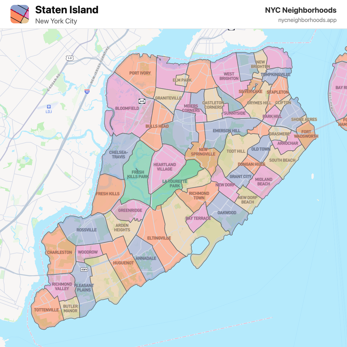
Staten Island Neighborhood Map
Staten Island is the southernmost and most suburban of New York City's five boroughs, known for its parks, historic sites, and close-knit neighborhood communities.
 Explore the Interactive Map →
All Staten Island Neighborhoods (62)
- Annadale
- Arden Heights
- Arrochar
- Bay Terrace
- Bloomfield
- Bulls Head
- Butler Manor
- Castleton Corners
- Charleston
- Chelsea-Travis
- Clifton
- Clove Lake
- Concord
- Dongan Hills
- Elm Park
- Eltingville
- Emerson Hill
- Fort Wadsworth
- Fresh Kills
- Fresh Kills Park
- Graniteville
- Grant City
- Grasmere
- Great Kills
- Greenridge
- Grymes Hill
- Heartland Village
- Huguenot
- La Tourette Park
- Lighthouse Hill
- Mariner's Harbor
- Meiers Corners
- Midland Beach
- New Brighton
- New Dorp
- New Dorp Beach
- New Springville
- Oakwood
- Old Town
- Park Hill
- Pleasant Plains
- Port Ivory
- Port Richmond
- Prince's Bay
- Randall Manor
- Richmond Town
- Richmond Valley
- Rosebank
- Rossville
- Shore Acres
- Silver Lake
- South Beach
- St. George
- Stapleton
- Sunnyside
- Todt Hill
- Tompkinsville
- Tottenville
- West Brighton
- Westerleigh
- Willowbrook
- Woodrow