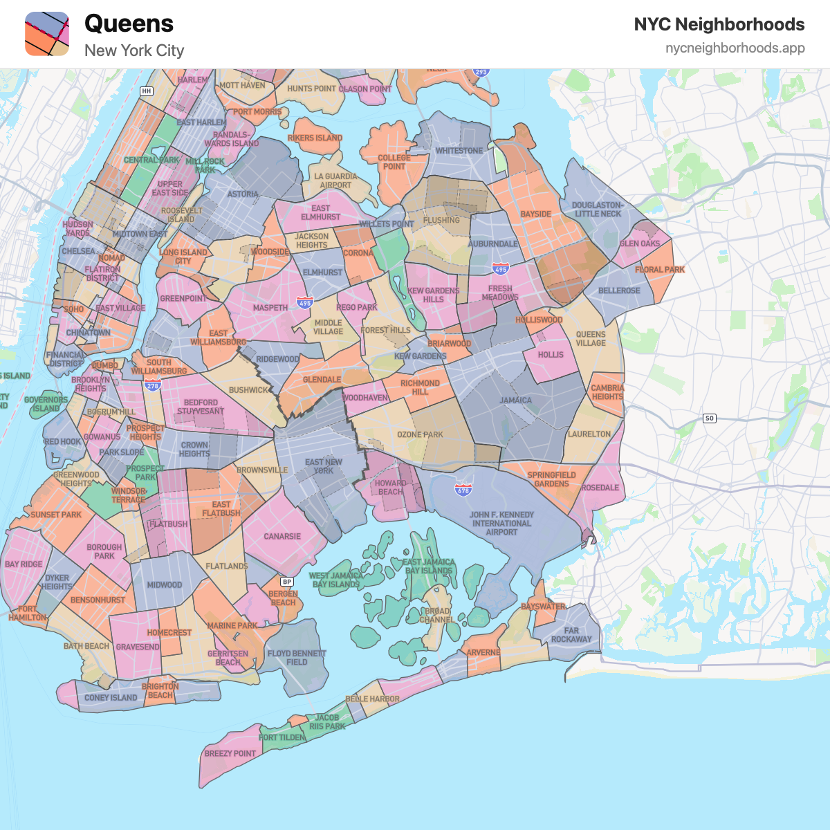
Queens Neighborhood Map
Queens is the largest borough of New York City by area and one of the most ethnically diverse places on Earth, home to JFK and LaGuardia airports and a mosaic of over 100 languages.
 Explore the Interactive Map →
All Queens Neighborhoods (57)
- Arverne
- Astoria
- Auburndale
- Bayside
- Bayswater
- Belle Harbor
- Bellerose
- Breezy Point
- Briarwood
- Broad Channel
- Cambria Heights
- College Point
- Corona
- Douglaston-Little Neck
- East Elmhurst
- East Jamaica Bay Islands
- Edgemere
- Elmhurst
- Far Rockaway
- Floral Park
- Flushing
- Flushing Meadows Corona Park
- Forest Hills
- Fort Tilden
- Fresh Meadows
- Glen Oaks
- Glendale
- Hollis
- Holliswood
- Howard Beach
- Jackson Heights
- Jacob Riis Park
- Jamaica
- John F. Kennedy International Airport
- Kew Gardens
- Kew Gardens Hills
- La Guardia Airport
- Laurelton
- Long Island City
- Maspeth
- Middle Village
- Neponsit
- Ozone Park
- Queens Village
- Rego Park
- Richmond Hill
- Ridgewood
- Rockaway Beach
- Rockaway Park
- Rosedale
- Roxbury
- Springfield Gardens
- Sunnyside
- Whitestone
- Willets Point
- Woodhaven
- Woodside